Quantity Rules and Regulations
Some changes required by adoption of the rules include:
- Well permits for new and replacement wells pumping greater than 50 gallons a minute.
- Expanding irrigation to previously non-irrigated acres requires a permit.
- Flow meters and annual groundwater use reports are required on all new high capacity wells.
- Best Management Practices (BMP’s) are encouraged to conserve and protect groundwater resources.
- Triggers are established which would bring about additional regulation in the case of prolonged groundwater declines.
- Other requirements are detailed in the Rules and Regulations. Contact LCNRD with questions.
Review the complete 2021 LCNRD Quantity and Quality Rules and Regulation
Integrated Management Plan (IMP)
On July 28, 2016, the Lewis & Clark Natural Resources District (LCNRD) Board of Directors approved adoption of an Integrated Water Management Plan (IMP) developed to protect groundwater and surface water quantity for the parts of Dixon, Cedar, and Knox Counties in the LCNRD. The IMP is available for online viewing or at the office of the LCNRD in Hartington.
The overarching purpose of this IMP is to provide a framework for joint management of groundwater and surface water resources to ensure the long-term availability of both resources, so that existing users are protected.
In 2023, the LCNRD and Department of Water, Environment and Energy (DWEE) completed the IMP biennial update. Refer to NeDWEE for more information about integrated management planning. Copies are also available at the LCNRD office in Hartington. 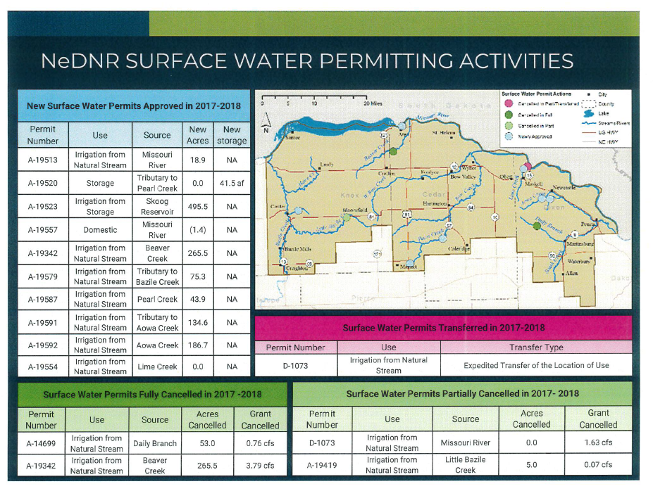
Water Levels
Spring 2026 Well Measuring Results
The purpose of the Lewis and Clark Natural Resources District's well monitoring is to record the groundwater levels and fluctuations in wells throughout the district. The LCNRD monitors trends in water level data to prepare for sustained decline.
The static water levels of 34 irrigation wells located throughout the Lewis and Clark Natural Resources District (LCNRD) are measured in the spring and fall each year. Groundwater levels measured this spring indicate an increase in 20 of the 34 wells monitored.
HydroVu
VuLinks and HydroVu help LCNRD track groundwater levels through the district by providing continuous, real-time well monitoring. Water level sensors installed in LCNRD's monitoring wells collect groundwater level data, and VuLinks automatically transmit the readings to the HydroVu cloud platform via cellular or satellite networks. This eliminates the need for frequent manual measurements and ensures that data is available from remote locations.
HydroVu organizes the incoming data into graphs, maps, and dashboards, allowing staff to quickly view current groundwater conditions and analyze long-term trends. By combining VuLinks with HydroVu, the district can efficiently monitor groundwater levels across multiple sites and maintain a more complete understanding of the aquifer health and behavior. To view LCNRD's monitoring network on HydroVu, click on the link. Disclaimer: The water levels are inverted, so when the line rises, it indicates a drop in water depth.
Well Permits & Expanded Irrigated Acre Permits
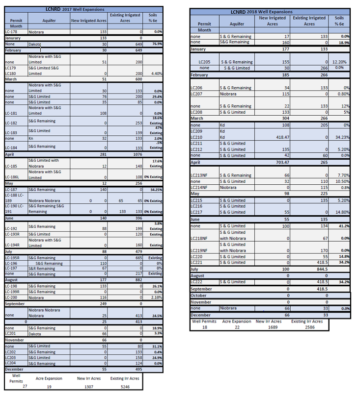
The LCNRD requires all new irrigation wells that pump 50 gallons or more a minute to go through a permitting process as of August 1st, 2014.
Well Permits are required on all new irrigation wells except for:
- Test holes or dewatering wells (used 90 days or less)
- Wells pumping 50 gpm or less
- New Permit fee is $50—Late filing fee is $250 (both are non-refundable)
Expanding Irrigated Acres Permit
- Required anytime applying irrigation water to acres that have not been previously irrigated.
- Expansion Permit fee is $50—Late filing fee is $250 (both are non-refundable)
Flow Meter Cost-Share
A flow meter must be installed on all new wells pumping >50gpm. Cost-share is available through the NRCS or the LCNRD for flow meters. Flow meters will assist the LCNRD effectively monitor groundwater use in the LCNRD.
- Cost-sharing is available through the LCNRD if it is newly irrigated acres and cost-sharing is available through NRCS if there is irrigated history on the acres. Applications can be filled out either at the NRD or the NRCS offices.
Groundwater Management Plan (GWMP)
To guide groundwater management, the LCNRD adopted a Groundwater Management Plan (the Plan) in 1986. The Plan was updated in 1995 and amended in 2014. The Plan provides the basis for groundwater management in the LCNRD.
If you would like to review the Groundwater Management Plans and updates they are available here.
 1986 GWMP
- 1995 GWMP Update
- 2004 Groundwater Quality Rules and Regulations
- 2014 GWMP Amendment
- 2014 Groundwater Quantity & Quality Rules and Regulations
- 2015 April 16 - Final Quantity R&R with figures.pdf