Aowa Creek Watershed Dams 1-3 and 22-3
The Lewis and Clark Natural Resources District will conduct a public scoping meeting at 6:30 PM Central Time, April 7, 2026, regarding the Aowa Creek Watershed Planning Process and Proposed Dam Rehabilitation for Dams 1-3 and 22-3. Dam 1-3 is located approximately 1.5 miles northwest of Ponca and 0.4 miles northeast of Highway 12, Lat 42°34'56.24"N, Long 96°43'39.36"W. Dam 22-3 is located approximately 4.5 miles northwest of Ponca and 0.8 miles northeast of Highway 12, Lat 42°37'16.00"N, Long 96°47'4.01"W. The meeting will be held at City Hall (123 W 3rd St) in Ponca, NE, with virtual attendance available.
Representatives from the Lewis and Clark Natural Resources District, City of Ponca, and United States Department of Agriculture – Natural Resources Conservation Service (NRCS) will lead and participate in the public meeting to seek input regarding preparation of a Supplemental Watershed Plan and Environmental Assessment. This planning process involves considering alternatives to reduce risks associated with the potential for catastrophic dam failure and flooding at Dams 1-3 and 22-3. Alternatives considered include: No Action, rehabilitation of both structures to 50-year sediment design life, rehabilitation of both structures to 100-year sediment design life, and decommissioning of either structure.
The objectives of the public scoping meeting include, but are not limited to, the following:
1. Ensure that the general public, private groups, and local, county, and state government agencies are thoroughly familiar with the potential dam rehabilitation planning process for Aowa Creek Watershed Dams 1-3 and 22-3.
2. Promote an atmosphere of extra-agency cooperation.
3. Provide a forum for the reception and consideration of public input regarding the projects.
4. Clarify the costs and effects of the preferred alternative under consideration.
5. Collect any existing resource data regarding the potential dam rehabilitation from agencies and citizens.
6. Incorporate written and verbal comments into the decision-making process.
Individuals requiring additional information, needing special accommodations to attend the meeting, or wishing to attend the meeting virtually should contact Melissa Baier (NRCS) at Melissa.Baier@usda.gov or call 402-437-4065.
LCNRD Board of Directors will review the meeting and decide further action at an upcoming board meeting.
For more information on the proposed plan, click on the link: https://www.nrcs.usda.gov/state-offices/nebraska/projects-ready-for-public-comment-and-revi.ew
Aowa Creek Flood Control Project
The Aowa Creek federal PL-566 Watershed project was initiated by Dixon County authorities and the Natural Resources Conservation Service (NRCS) sponsorship of the project was later transferred to the Lewis and Clark Natural Resources District (LCNRD). The primary purpose is flood protection for the communities of Newcastle and Ponca and the rural residents of the Aowa Creek watershed and its tributaries. Secondary benefits include erosion control, sediment retention, wildlife habitat, and recreation.
At the time of project consideration in 1969, there were 230 family farms in the watershed with an average farm size of 240 acres. 50 grade stabilization and flood control dams were completed, protecting approximately 55,000 acres. Of the 50 structures, 10 are flood retarding structures, and 40 are grade stabilization structures. Two of the 50 structures are managed as Wildlife Management Areas (WMAs) and are open to public use; Buckskin Hills and Powder Creek.
Flood Prevention & Control
LCNRD has cooperated with various entities to construct flood control structures that protect the lives and properties of local residents and communities.
The Lewis & Clark NRD has provided assistance to county governments to finance road structures and replace bridges with flood control dams. The Aowa Creek federal PL-566 Watershed project in Dixon County was completed with 50-grade stabilization and flood control dams. The project protects 55,000 acres and the communities of Newcastle and Ponca.
The Nebraska Natural Resources Commission, Natural Resources Conservation Service (NRCS), and other partners assisted with funding and technical support for the construction of Buckskin Hills Lake (1980), Chalkrock Lake (1986), and Powder Creek Lake (2003). These structures located in Cedar and Dixon Counties not only provide flood control but also public recreation opportunities. These facilities are managed by Nebraska Game and Parks as Wildlife Management Areas (WMAs).
Recreation
Nebraska Game and Parks Commission rules and regulations for hunting and fishing apply at all three WMAs. Boats are restricted to 5pmh (no wake). For more information about public access at LCNRD WMAs and other public access areas in Nebraska visit the Nebraska Game and Parks Website.
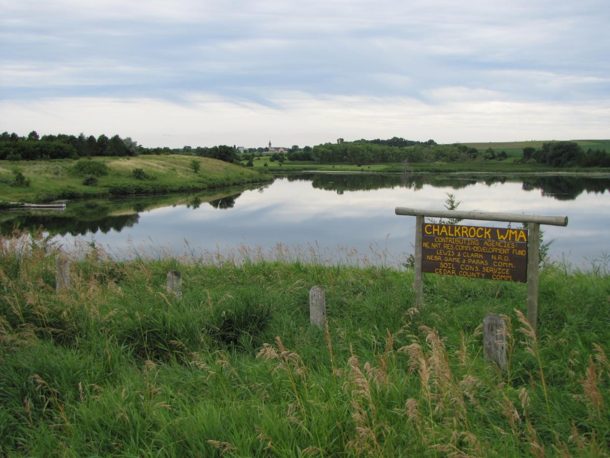
Chalkrock Wildlife Management Area
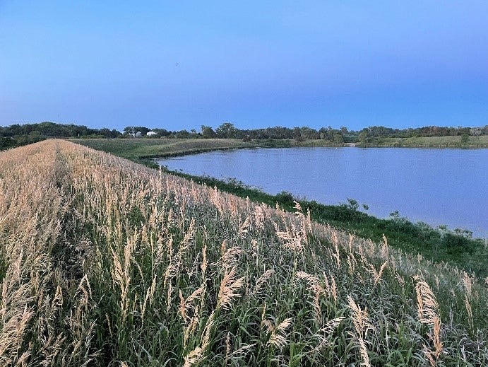
Chalkrock Wildlife Management Area (WMA) is a 130-acre wildlife area with a 44-acre lake located near Menominee in Northern Cedar County. The lake was constructed in 1986 by JP Theisen and Sons, Osmond, NE, as a flood and erosion control structure. The dam drains 11,500 acres, is 61 feet high, and has a flood storage capacity of 181 acre-feet above normal pool level.
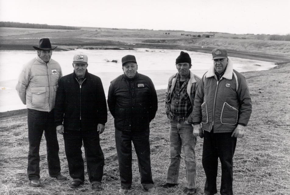
Touring the newly completed Chalkrock Lake (1986) are the landowners (left to right: Virgil Schmidt, Harold Schaefer, John Mueller, Vern Zavadil, and Stanley Schmidt) who donated land for its development.
The construction of the Chalkrock Dam was made possible by landowners who donated property for development of the area. Stanley Schmidt, John Mueller, Vern Zavadil and Harold Schaefer (see photo above) donated ground for the development of Chalkrock. The Lewis & Clark Natural Resources District sponsored the project along with the Cedar County Commissioners, who provided funding for 25% of the cost. Grants from the Nebraska Department of Natural Resources (NeDNR) Resources Development Fund provided funds for 75% of the project. Total project cost was $503,438. Annual benefits to protected county roads, farmland, and public use are approximately $14,400 per year.
The structure provided significant protection to the downstream county road and downstream landowners when the March 2019 Bomb Cyclone impacted the area. The emergency spillway of the structure fuctioned as designed and diverted large amounts of water that exceeded the capacity of the primary spillway. The project was designed and engineered by the Natural Resources Conservation Service (NRCS). It is operated and maintained by the Nebraska Game & Parks Commission as a Wildlife Management Area. The Chalkrock WMA is open to boating, hunting, and fishing. Hunting game includes deer, pheasants, and waterfowl. Fish stocked include Largemouth Bass, Bluegill, and Channel Catfish.
Chalkrock WMA is located 1 ½ miles east of Highway 81 on 895 Road https://www.nrdnet.org/rec-area/chalkrock-wma
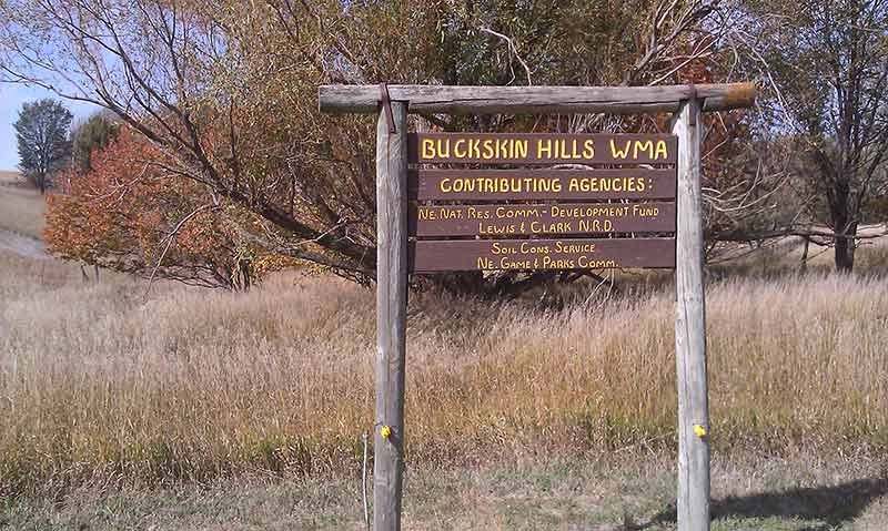
Buckskin Hills Wildlife Management Area
The project was designed and engineered by the Natural Resources Conservation Service (NRCS). It is operated and maintained by the Nebraska Game & Parks Commission as a Wildlife Management Area (WMA)

The Lewis and Clark Natural Resources District sponsored the construction of Buckskin Hills WMA in 1980 as an erosion and flood control structure for the Aowa Creek Watershed Project.
Buckskin Hills WMA includes 340 acres of public-use land. The dam is 57 feet high with a 75-acre lake. The lake is stocked with Largemouth Bass, Bluegill, Channel Catfish, Black Crappie, and Walleye. For the hunter, there is excellent habitat with pheasants, quail, deer, waterfowl, and dove. Other amenities include a boat ramp, public restrooms, and ample areas for hiking around the lake.
A ![]() bathymetric survey, which represents the current contours of the lake may help fishermen determine the best places for fishing success. The survey was conducted with the Nebraska Department of Environment and Energy (NDEE) funding.
bathymetric survey, which represents the current contours of the lake may help fishermen determine the best places for fishing success. The survey was conducted with the Nebraska Department of Environment and Energy (NDEE) funding.
Buckskin Hills is located 2 miles west of Newcastle on Highway 12 and 2 miles south on 581 Avenue. https://www.nrdnet.org/rec-area/buckskin-hills-wma
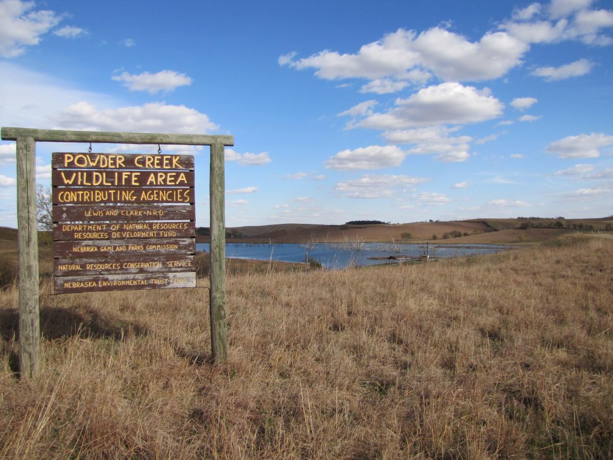
Powder Creek Wildlife Management Area
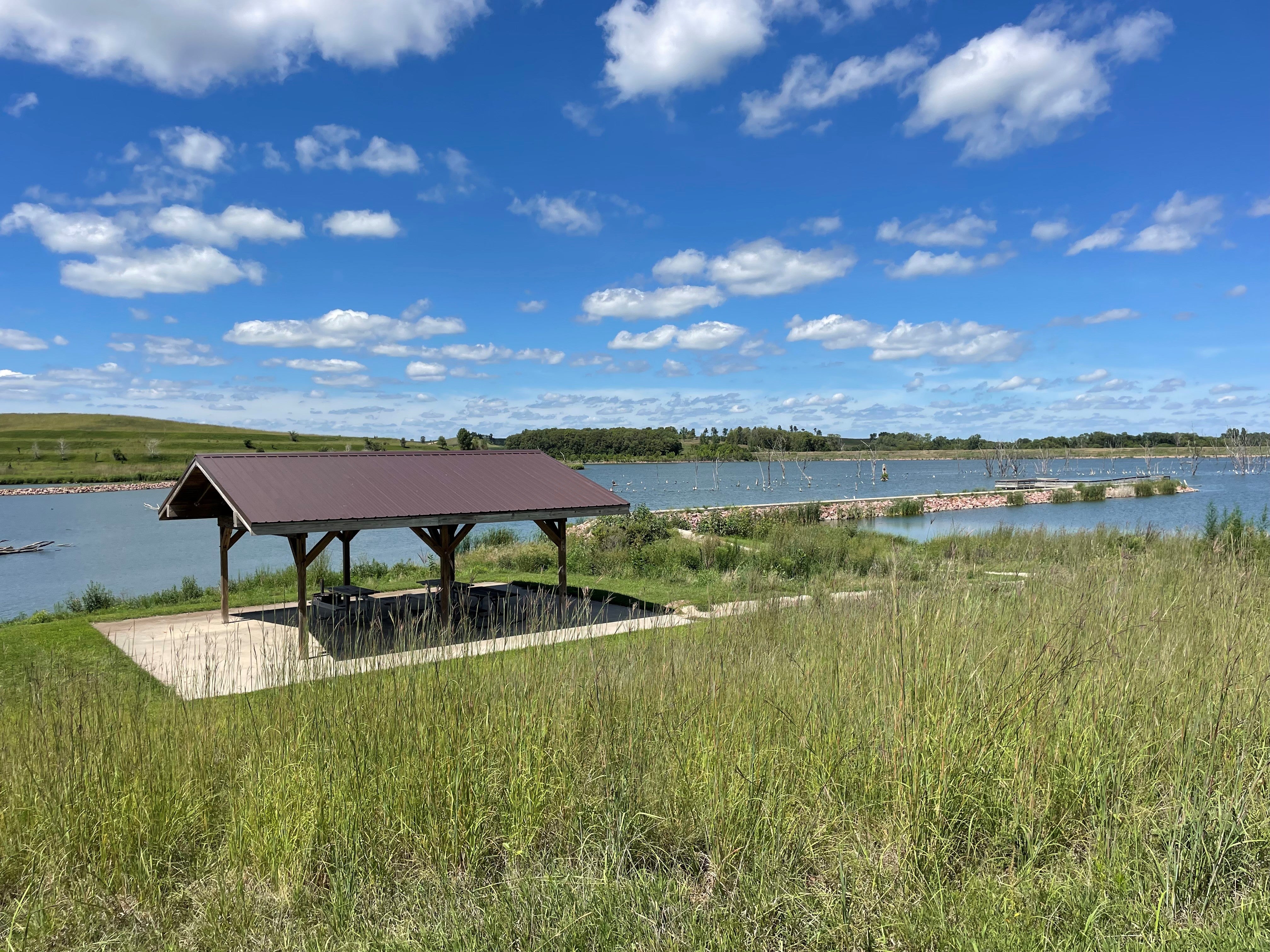
The Lewis and Clark Natural Resources District sponsored the construction of Powder Creek WMA in 2003 as an erosion and flood control structure for the Aowa Creek Watershed Project. The Wildlife Management Area (WMA) covers 467 acres, including a 107-acre lake.
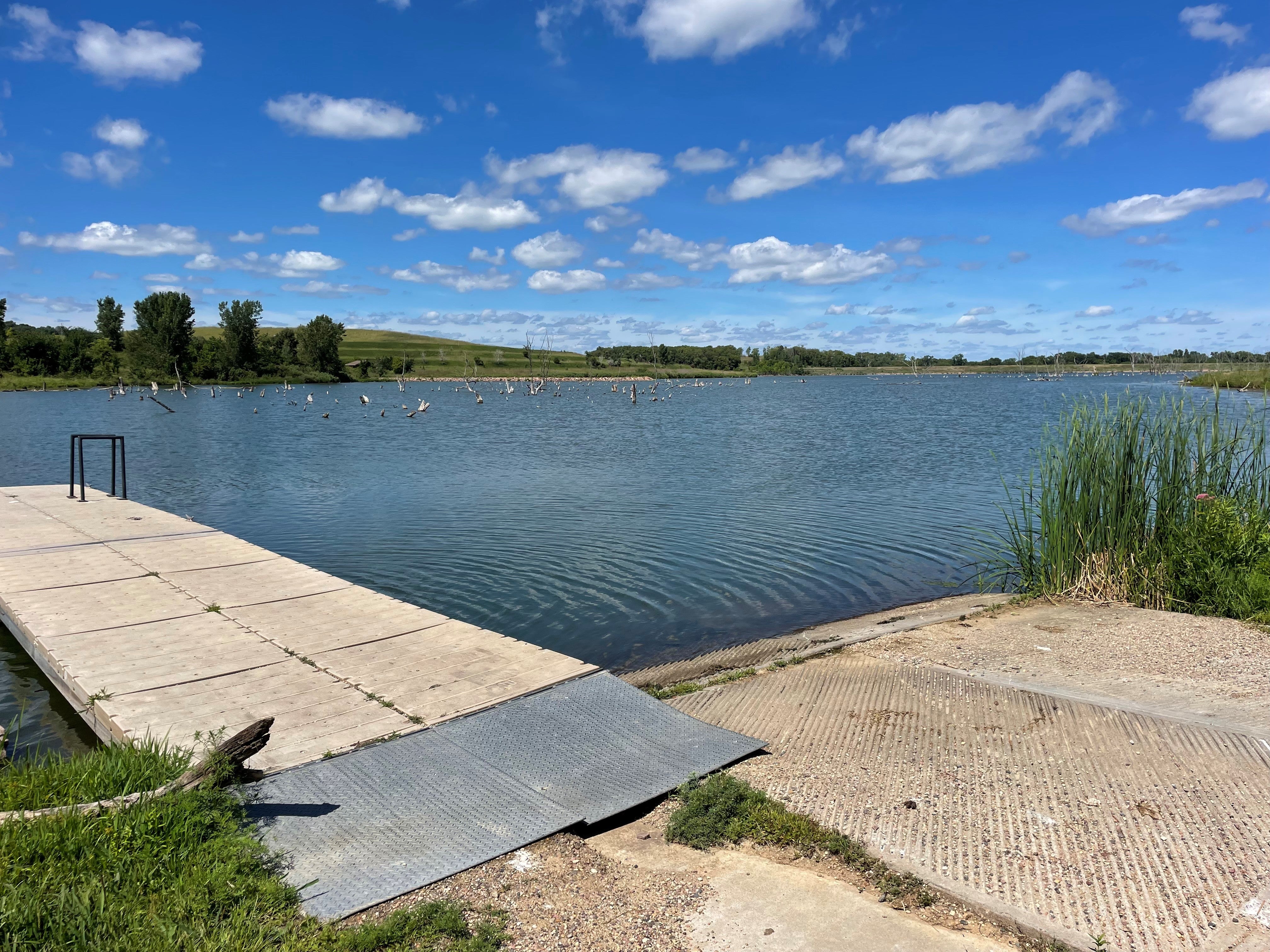
The Nebraska Game and Parks Commission manages Powder Creek as a Wildlife Management Area. There are primitive camping sites and public restrooms on-site. A boat dock makes this lake good for fishing.
The lake has been stocked with Bluegill, Channel Catfish, Largemouth Bass, Walleye, Black Crappie, and Flathead Catfish. Hunting opportunities include pheasant quail, deer, waterfowl, and morning dove.
A ![]() bathymetric survey, which represents the current contours of the lake may help fishermen determine the best places for fishing success. The survey was conducted with the Nebraska Department of Environmental and Energy (NDEE) funding.
bathymetric survey, which represents the current contours of the lake may help fishermen determine the best places for fishing success. The survey was conducted with the Nebraska Department of Environmental and Energy (NDEE) funding.
Powder Creek Lake is located 2 miles east of Newcastle on Highway 12 and 2 1/2 miles south on 585 Avenue. The address is 88082 585 Road, Ponca NE 68770. https://www.nrdnet.org/rec-area/powder-creek-wma
Missouri River Programs
The Lewis and Clark Natural Resource District borders Lewis and Clark Lake and the Missouri River. The LCNRD recognizes this unique natural feature and its value as a resource to the region. The Missouri River provides habitat for fish and wildlife recreation opportunities and is a drinking water source for local residents. Conservation and protection of this natural resource is essential to maintaining a healthy environment along the northern corridor of the district.
Missouri National Recreational River
The Missouri National Recreational River is managed as a National Park by the National Park Service in cooperation with the US Army Corps of Engineers. Two free-flowing stretches of Missouri make up the National Park, including the lower 59-mile stretch from Gavins Point Dam to Ponca, NE, which runs along the northern border of LCNRD. LCNRD has been active in providing input on management decisions and strives to collaborate on issues affecting local landowners’ ability to protect their property. The Missouri National Recreational River Water Trail is a boating trail that is sponsored by the LCNRD.
Section 32 Bank Protection
The Section 32 Bank Protection Projects were built in the late 1970s NRD sponsorship on 5 sites along the Nebraska side of the Missouri River. The LCNRD acquired easements for the demonstration projects. LCNRD continues to assist the US Army Corps of Engineers on maintenance activities to reduce riverbank erosion losses.