Classroom Presentations & Activities
The Lewis & Clark Natural Resources District (LCNRD) offers a variety of hands-on activities, classroom presentations, career exploration, and more! All activities are free of charge and presented by an LCNRD I&E Technician! Most activities can be adjusted to fit specific classroom needs for Kindergarten through 12th grade.
Water Quantity
Nebraska sits atop the largest aquifer in the United States, but most of northeast Nebraska does not sit on it! Find out about the aquifers where we get our groundwater. Examine aquifers and the importance of groundwater conservation by creating an aquifer, and observing an aquifer model demonstration.
Water Quality & Flow Model- H2Oh No!
Explore the importance of water quality and its impacts on human health. Activities include: using colorimeters to test the levels of nitrates in water samples, point and non point source contamination, and an aquifer contamination model.
Enviroscape
See firsthand the outcomes of point and non-point contamination. Enviroscape is an interactive 3-D model that illustrates residential, recreational, agricultural, industrial, and transportation areas - all representing possible sources of water pollution in the environment.
We All Live in a Watershed
Students will help create industrial, agricultural, and recreational parts of a watershed and show how each part affects the watershed. They will see how different pollutants affect the watershed. They will be given the chance to be creative and show how their everyday life affects the watershed they live in even if they are not aware of it.
Know Your Well Project
Educates students about the importance of water quality in the community. Students are able to connect the community by collecting, testing, and analyzing the results of water samples from private domestic wells. This is a long term project great for 9th through 12th grade FFA Chapters or science classes.
Project WET: Water Education Materials
Project Wet is dedicated to solving the critical environmental challenges by teaching the world about water. It provides hands-on, science based water education resources to all ages. These resources encourage responsible environmental stewardship and promote meaningful action to address environmental challenges, climate change, social justice, and sustainability.
NeRAIN Program
NeRAIN is a program designed to get citizens involved with monitoring weather across the state. Information is updated daily and then is sent off to an international database for precipitation and weather events. The data provides important daily decision-making information. Rain gauges are provided for daily readings by the class.
Don't Lose Ground
Soil is essential for growing food for the world! Investigate various scenarios of soil erosion and conservation practices.
Composting & Vermiculture
Worms are an important part of the soil biome and are needed to breakdown organic matter. Students will learn about soil biology, worms, composting and how to build a worm farm. Worms help rebuild nutrient drained soil.
Arbor Day Tree Presentation
Trees are important to life as we know it, from the food they produce, the shade they provide, the wildlife habitat they create, and the countless products humans produce from them. Providing seedlings offers a hands-on opportunity to understand, respect, and protect trees and other natural resources.
Q & A with a Forester
LCNRD partners with Nebraska Forest Service with tree conservation programs. Have a Q & A with the local forester right in the classroom.
Reduce, Reuse, and Recycle
Recycling is an important way to reduce the impact of our waste on our community, locally and globally. It is a very easy thing to do, and it matters more than you think. Students will determine what garbage items can be reduced, reused, and recycled.
Natural Resources Career Jeopardy
Natural resources and the people who help protect these natural resources are very important to our communities. Explore the various career opportunities in natural resources, conservation, and agriculture.
Habitat Hopscotch
Students will learn about how important wetlands and other habitats are to migratory species in the Midwest. They will also learn how conservation plays a crucial role in protecting these flyways, and how poor conservation can make these cross-country journeys more difficult.
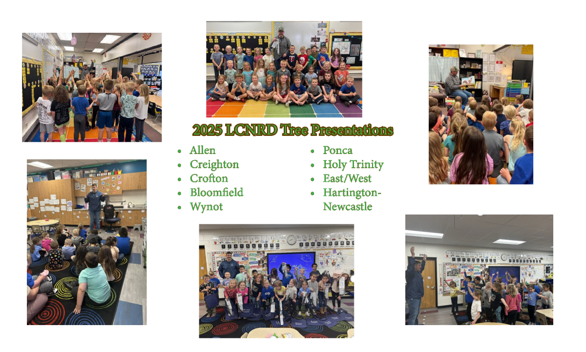
Arbor Day Presentations
Earth Day and Arbor Day are special days set aside to recognize the importance of trees and natural resources. They also provide an ideal opportunity to teach our youth about the value of trees in our lives. Trees are integral to life as we know it, from the food they produce, the shade they provide, the wildlife habitat they create, and the countless products humans produce from them. It is important to teach the nation’s youth to understand, respect, and protect trees and other natural resources.
The Lewis & Clark Natural Resources District (LCNRD) provides seedlings to area kindergarten classrooms. During each classroom visit, Jen Arena read a story called “Acorn Was A Little Wild” to the kindergarteners. It depicts the life of an acorn from seed to oak. Then, the kindergarteners participated in a tree life cycle activity where the kids pretended to grow from seed to large oak trees, which was a big hit! The kids were also instructed on how to plant their seedlings and where to properly plant them with adult supervision. The last few minutes are set aside for questions and silly tree stories that the students want to share. Conservation partners delivered trees and facilitated programs to 4th graders in Crofton and Hartington.
If you are interested in any of these programs and would like to learn more about them, refer to the I&E Curriculum Summaries or contact the Information & Education Technician.